 FREE SHIPPING ON ORDERS OVER $30
FREE SHIPPING ON ORDERS OVER $30
 Sale!
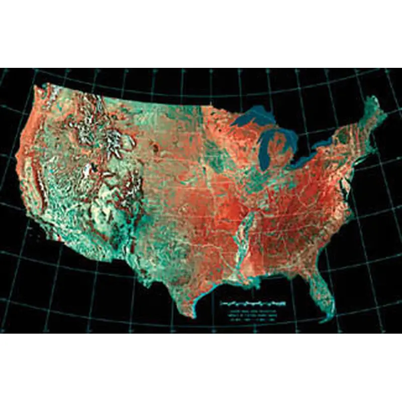
Sale! Albers Equal Area Projection Mosaic of Fifteen AVHRR Images 24 May, 1984 - 14 May, 1986 Add the most accurate-possible area map of continental America to your wall! Using the Albers method, this poster gives you a bird's-eye satellite view of the USA, with
Albers Equal Area Projection
Mosaic of Fifteen AVHRR Images
24 May, 1984 – 14 May, 1986
Add the most accurate-possible area map of continental America to your wall! Using the Albers method, this poster gives you a bird’s-eye satellite view of the USA, with every state appearing in precise proportional size to each other. The major mountain ranges, plains, and river valleys are visible through colorful shading, and the state borders are marked in white. Perfect for any lover of the greatest country on earth!
Poster Specifications:
Standard Shipping
Cost: $25
Free Shipping
We offer free shipping on orders over $30. Please check the free - shipping eligibility at checkout.
Delivery Time:
It usually takes [3-5] business days for standard shipping. Please note that this is an estimated time frame and may be affected by local holidays, and unforeseen circumstances.


Reviews
There are no reviews yet.